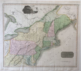
Northern Provinces of the United States, Thomson's New General Atlas
[Edinburgh]: John Thomson, 1817. N.R. Hewitt. 21 1/4'' x 24 3/4''; 19 3/8'' x 23'' within the neat line; original folds; a few light creases; very good. Map includes and identifies rivers, lakes, mountains, state boundaries, several forts, native peoples' lands, bank and ledges off the eastern shore and parts..... More