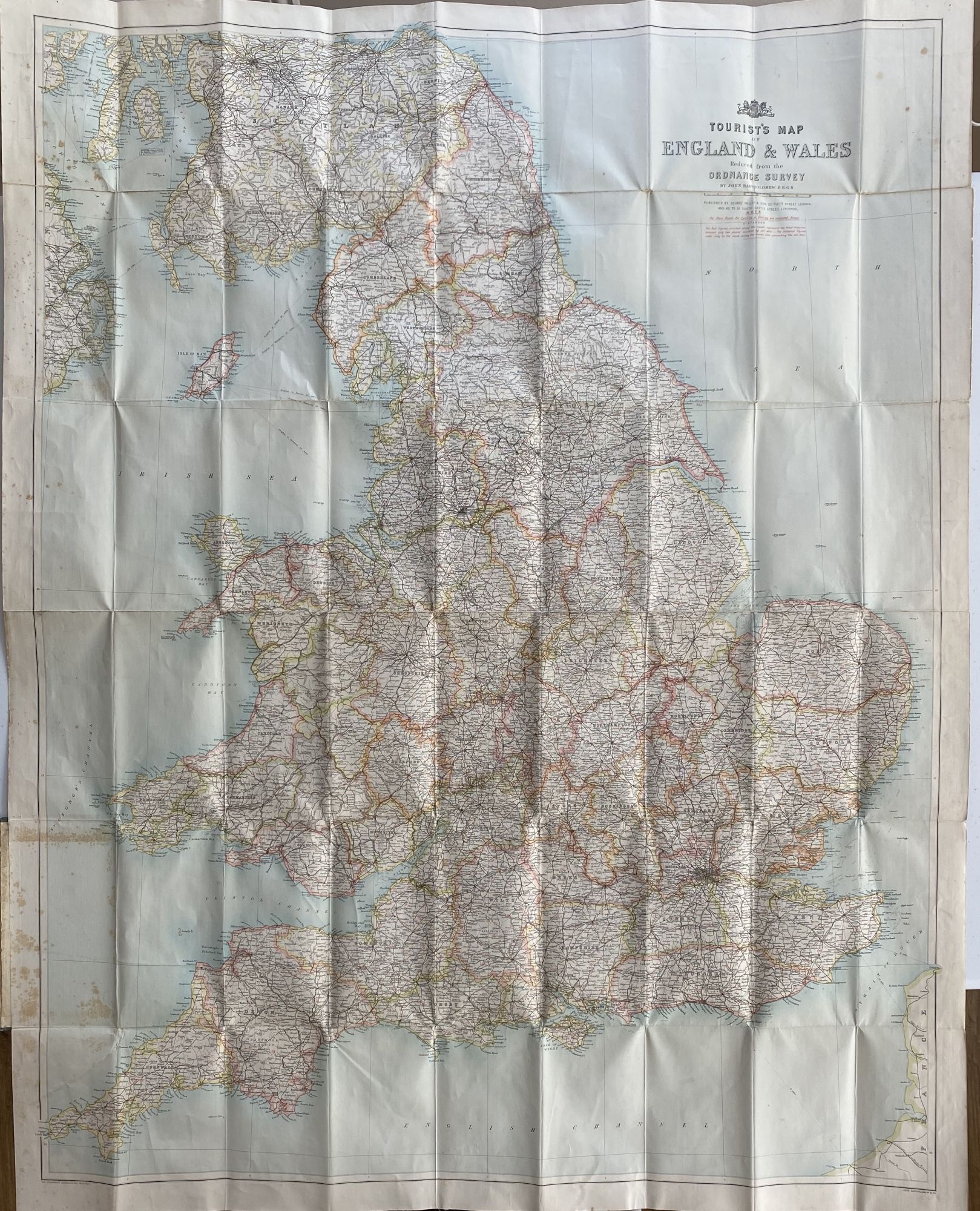
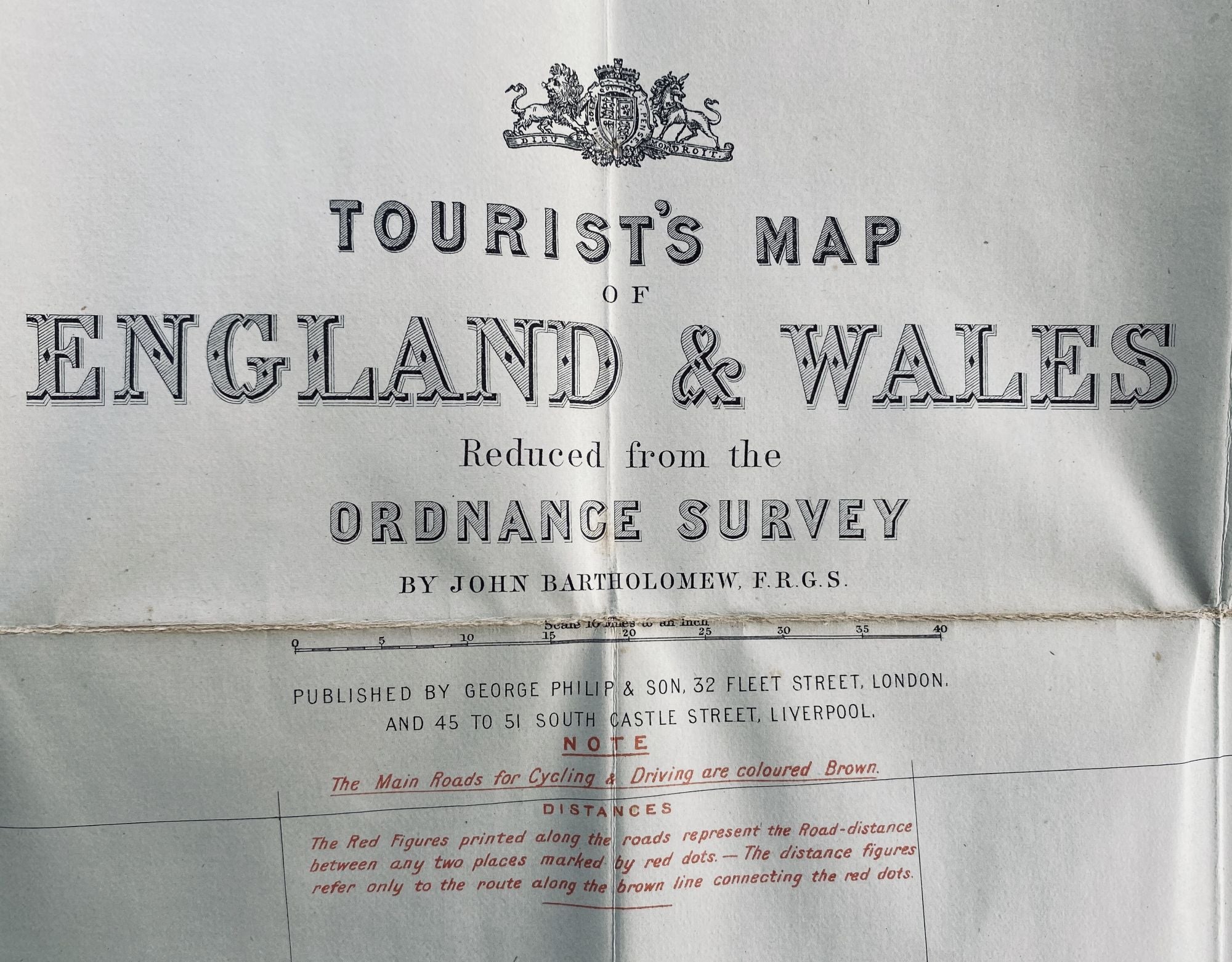
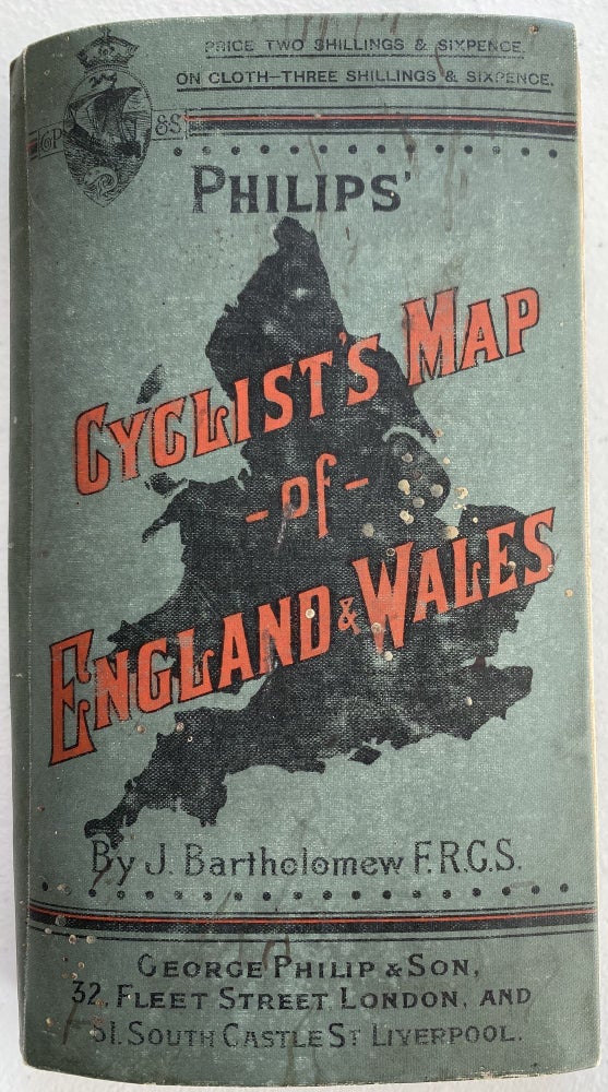
Tourist’s Map of England & Wales from the Ordnance Survey; Cover title: Philips' Cyclist's Map of England & Wales, by J. Bartholomew FRGS
London: George Philip & Son, 32 Fleet Street, and Liverpool, No date [c. 1880-1890]. Cloth. [POCKET MAP]. Wrapper: 57 5/8” x 4 ½”; glazed green cloth wrapper printed in red and black, silhouette of England on front; publisher’s ad to front pastedown and back of map; light scuffing and soiling to wrapper; very good.
Map: 43 ½” x 34 ¼” sheet size; 41 x 31 ¾” within neat line; cloth backed paper; printed in color half-tone; foxing to left side map and pastedown; very good. Very good. Item #1171
Large bright map of England and Wales with routes clearly noted in color. Key notes, Main roads for cycling and driving are coloured in Brown. Distances also noted.
Price: $175.00