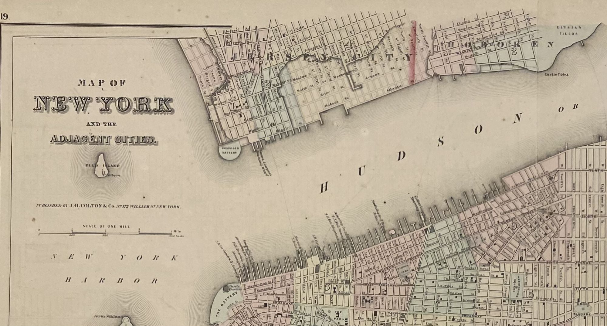
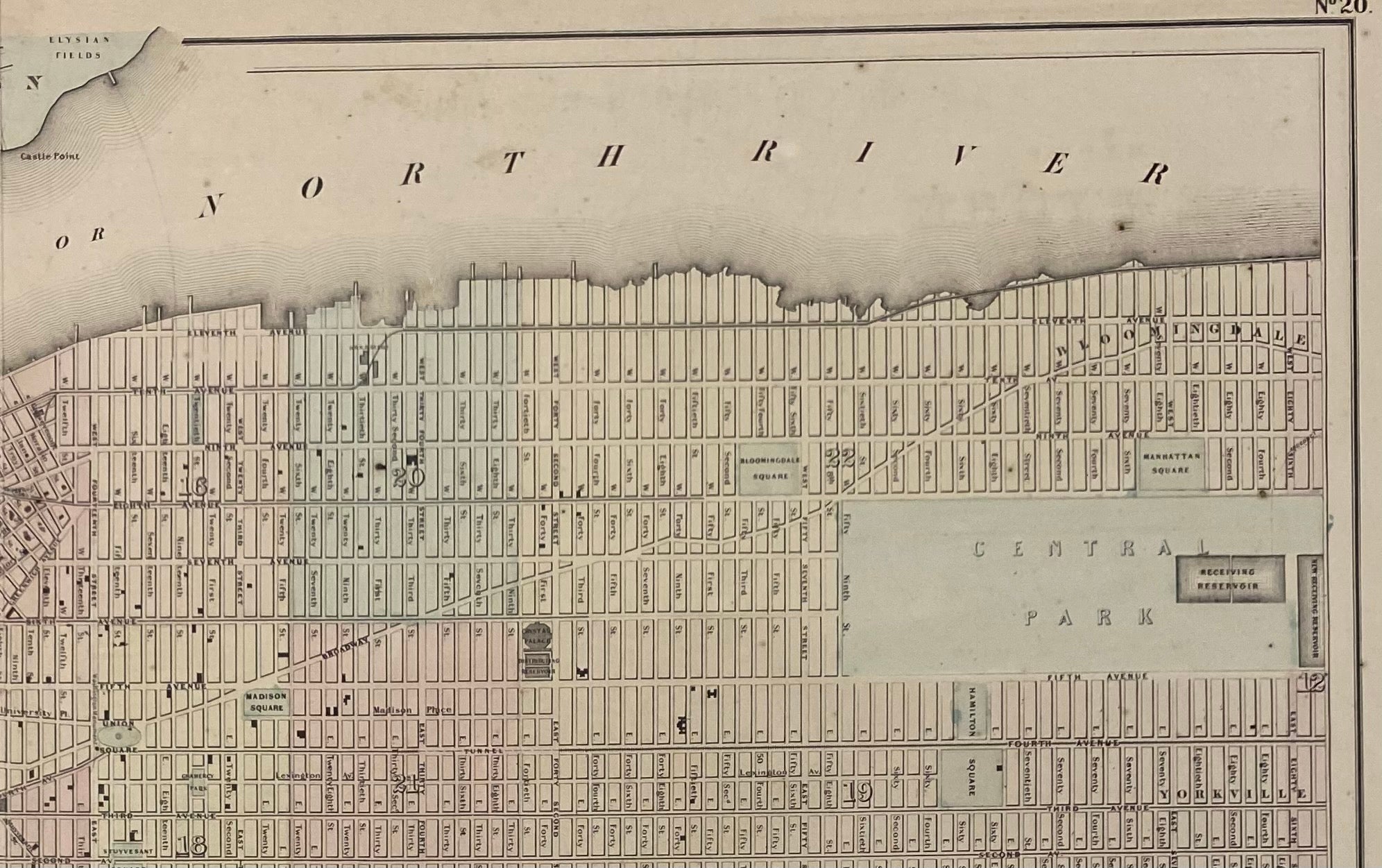
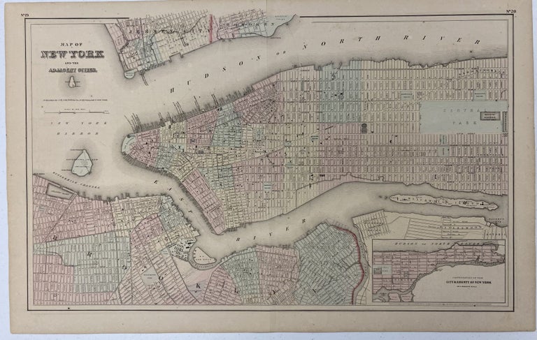
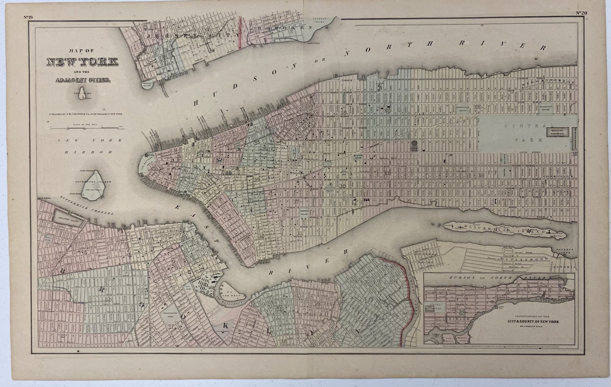
Map of New York and Adjacent Cities; Recto: State of New Jersey
New Yok: J. H. [Joseph Hutchins] Colton & Co., 1855/1857. Map no binding. Inset map: Continuation of the City and County of New York on a reduced scale.
17 ¼” x 27”; 15 1/8: x 24 7/8” within the neat line; engraved and hand-colored; light age-toning of paper, a few spots; near fine. Near fine. Item #1255
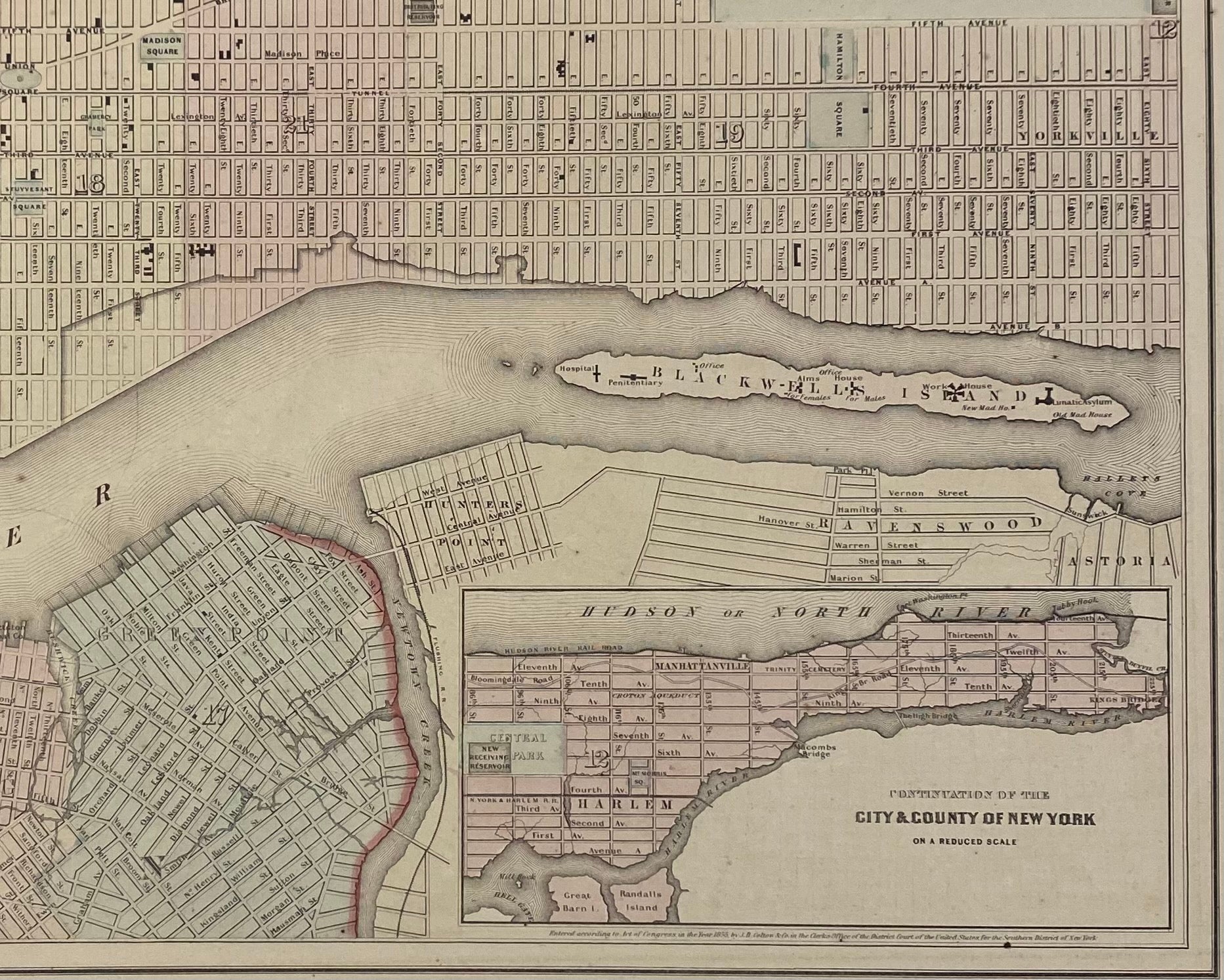
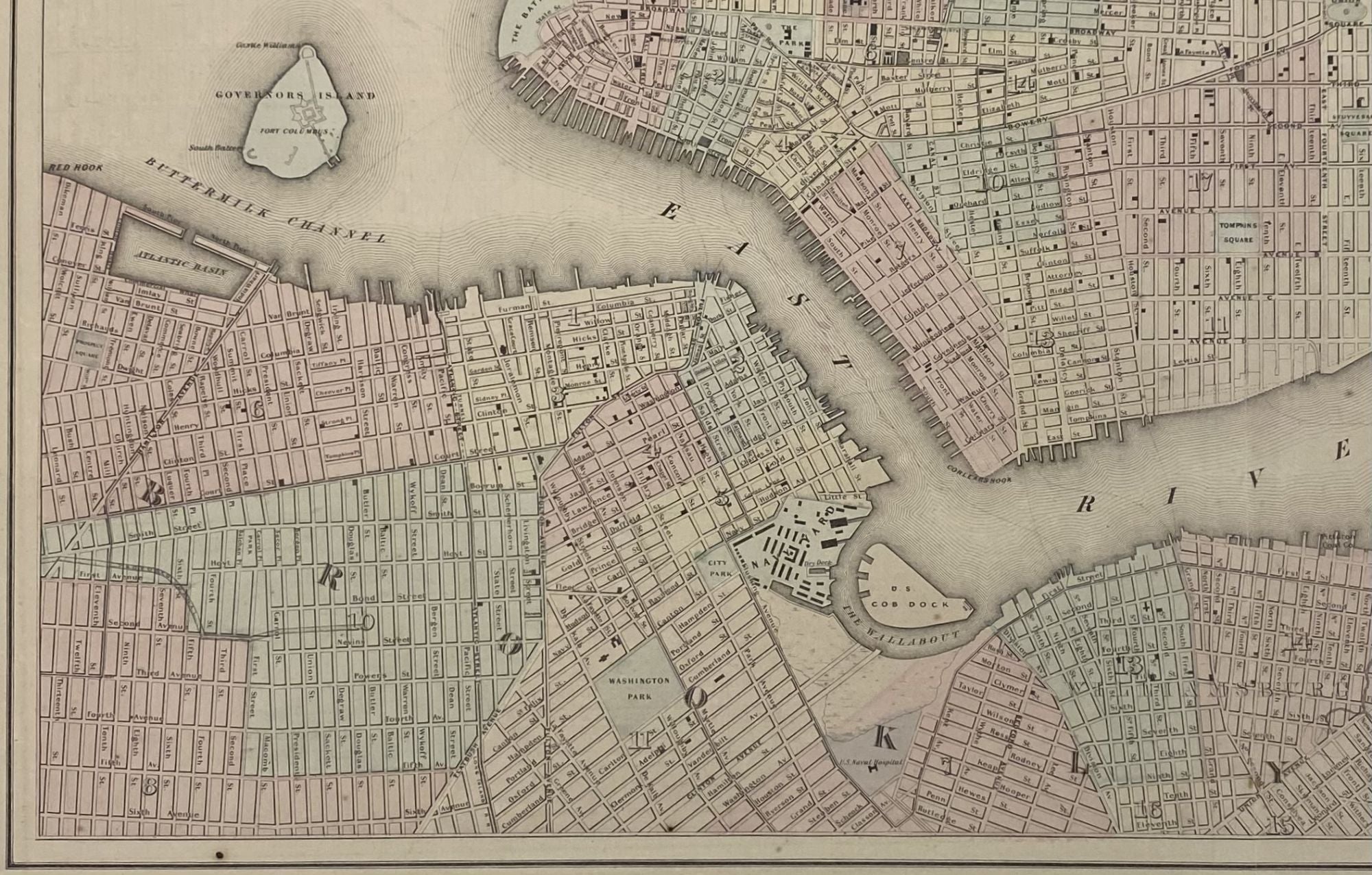
Interesting map showing the streets, neighborhoods, rivers and other geographical sites in the city of New York. First published in 1855, this is the 1857 printing of the same map. The map identifies the city neighborhoods including Astoria, Bloomingdale, Brooklyn, Greenpoint, Harlem, Hunters’ Point, Manhattanville, Ravenswood, The Wallabout, Williamsburg, and Yorkville. The Hudson or North River and the East River are identified along with the Atlantic Basin, Buttermilk Channel, Hallet’s Cove, Hell’s Gate, Newtown Creek, and Rushwick Creek. The Battery, Corlear’s Hook, and Red Hook are all labeled. Islands located within the map include Ellis Island, Governor’s Island (along with its structures), Great Barn Island, and Randall’s Island. The U.S. Navy Yard, Cob Dock, and Naval Hospital are located. There’s labeling of Squares and Parks, docks with ownership, and significant structures. A highly detailed map of New York for those who love the city!
Price: $375.00