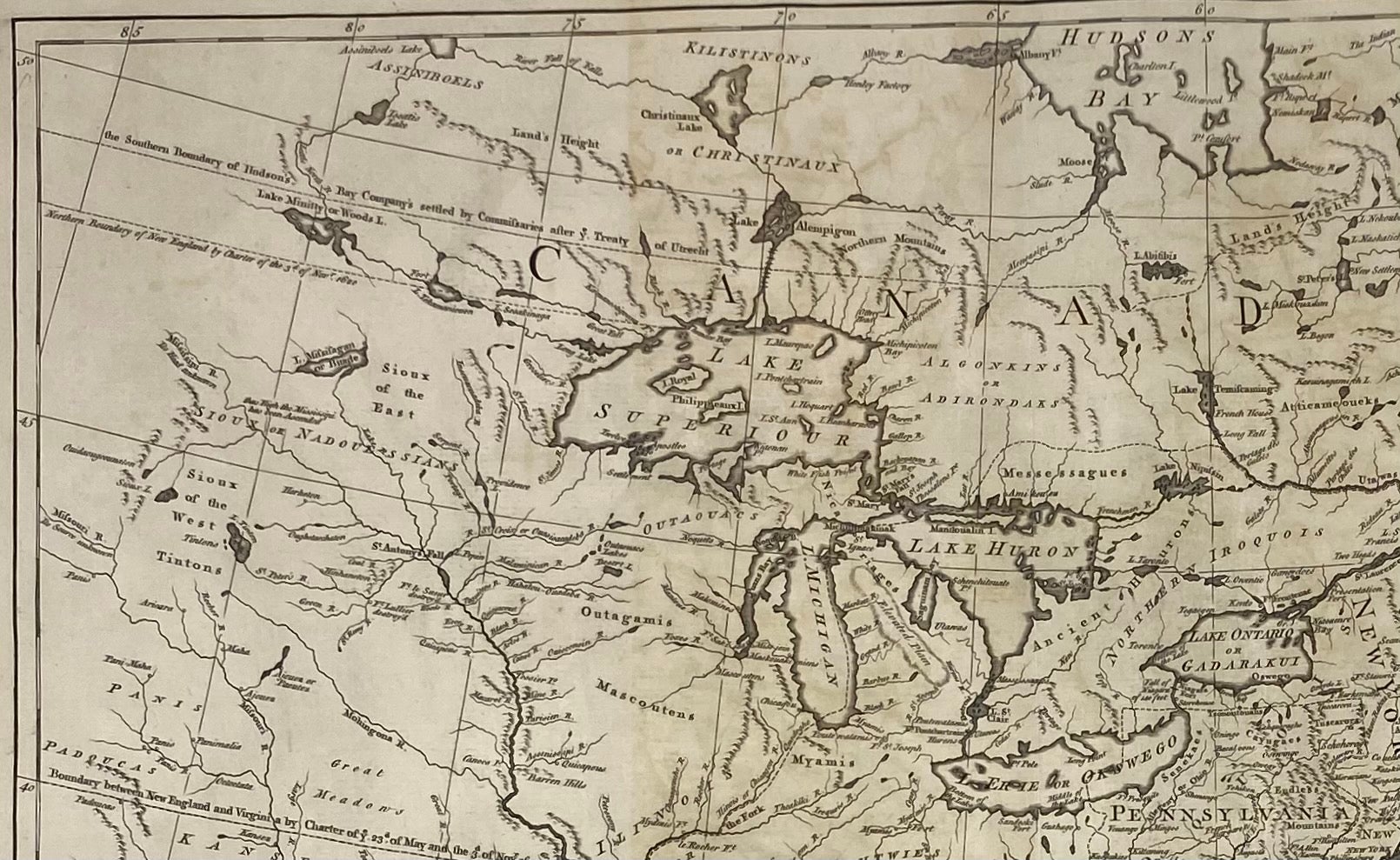
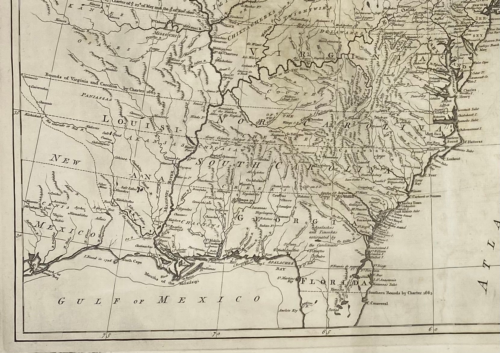
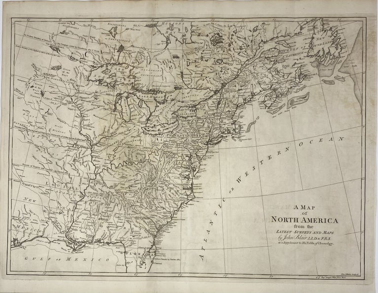
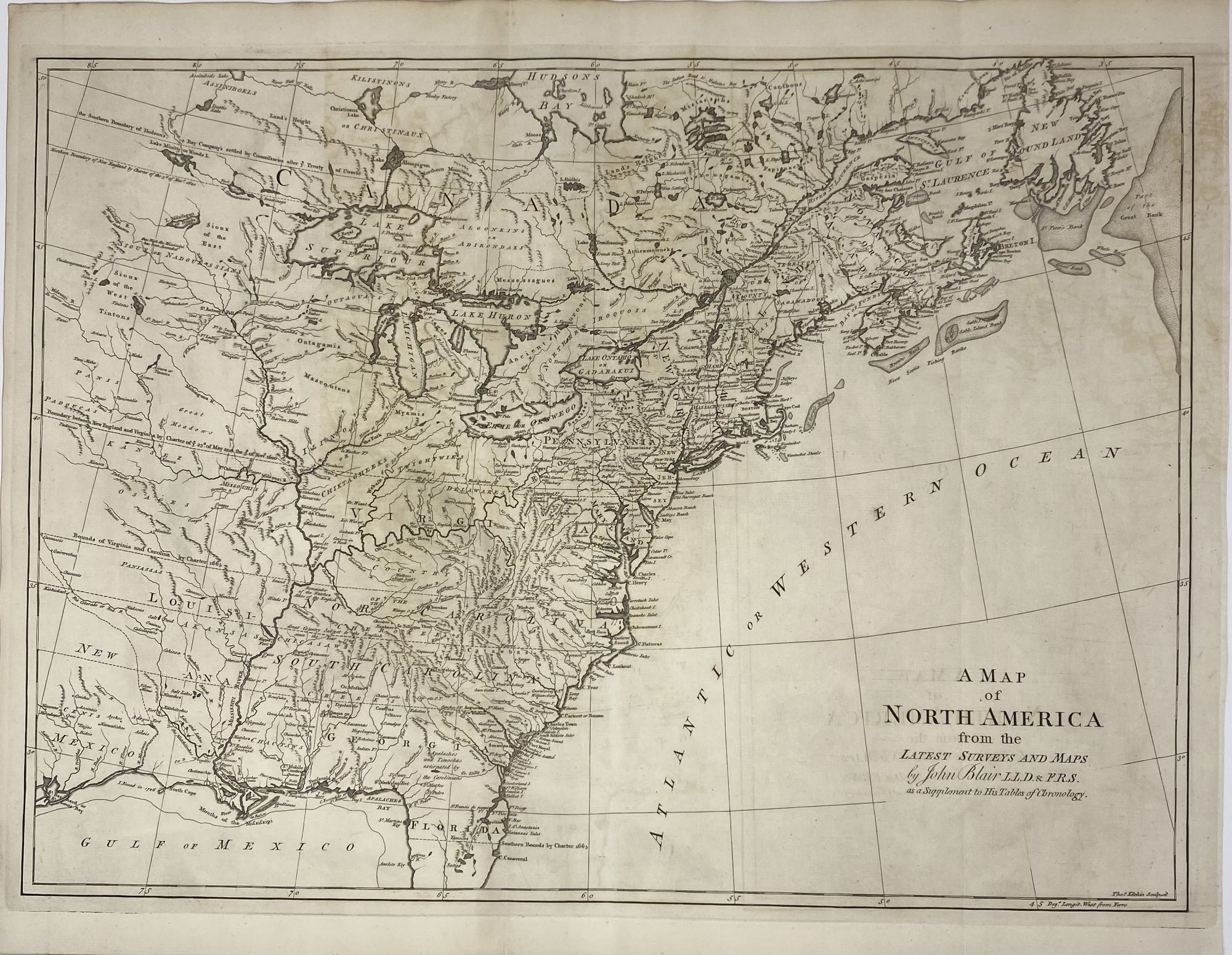
A Map of North America from the Latest Surveys and Maps, by John Blair, L.L.D. & F.R.S. as a Supplement to His Tables of Chronology
London: 1768. Thomas KITCHEN, engraver. Map no binding. [COLONIAL AMERICA]. 18 ¾” x 23 ¾” sheet size; 16 ½” x 22 ¾” within the neat line; vertical fold as issued in the atlas; well defined plate mark, wide margins; light offsetting of ink, else fine. Fine. Item #1441
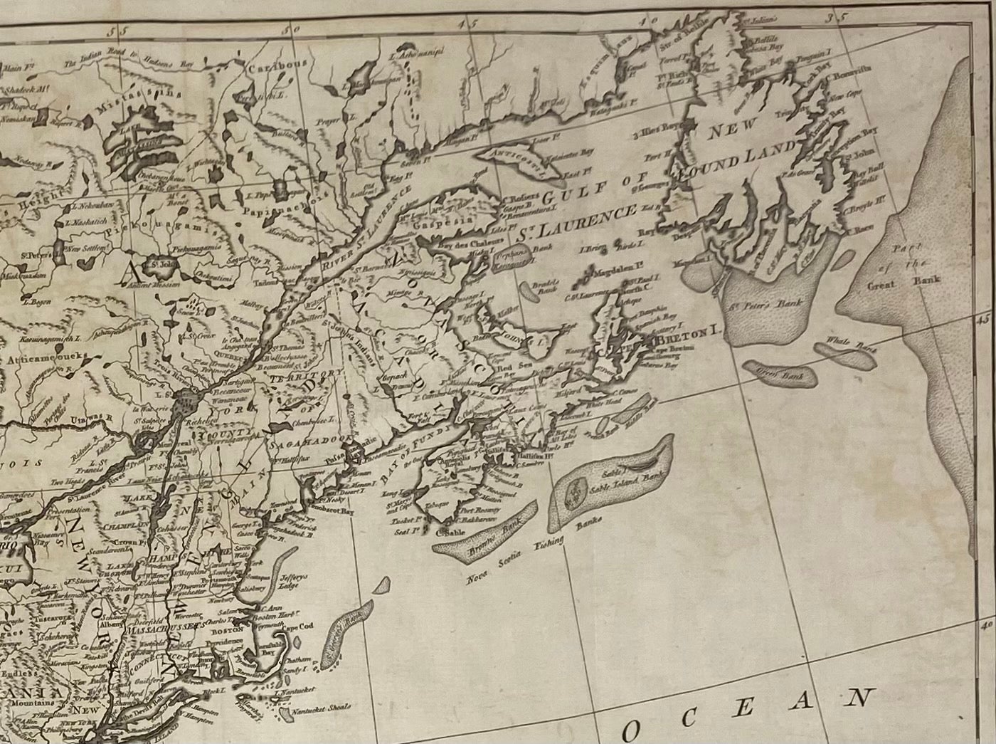
A captivating clear map of the eastern coast of British North America extending up into the maritime provinces of Canada in the east, as far west as Lake Superior and the plains beyond in the north, and west of the Mississippi River to what is now Texas in the south. The map clearly identifies and names Native Tribal areas. Of the American colonies, only 12 of the 13 are identified, as the borders for Delaware are included with Pennsylvania. Also identified are areas titled Florida, Louisiana, New Mexico [Texas], Main [Maine] (then a part of Massachusetts), and Canada with Nova Scotia or Acadia, and New Foundland. The Atlantic or Western Ocean shows the location of the fishing banks so important to the economy of Great Britain. The watermark for the renowned English paper maker, J WHATMAN [James Whatman], can be seen easily, along with their fleur de lis logo used at this time.
Price: $900.00