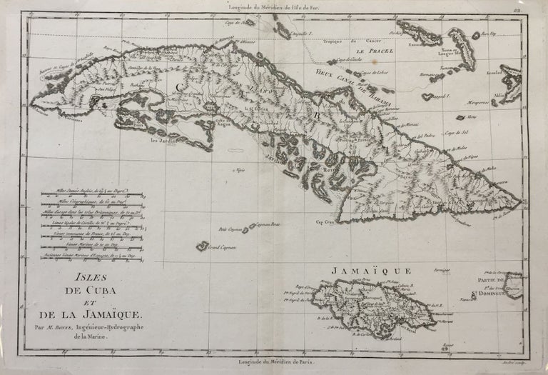
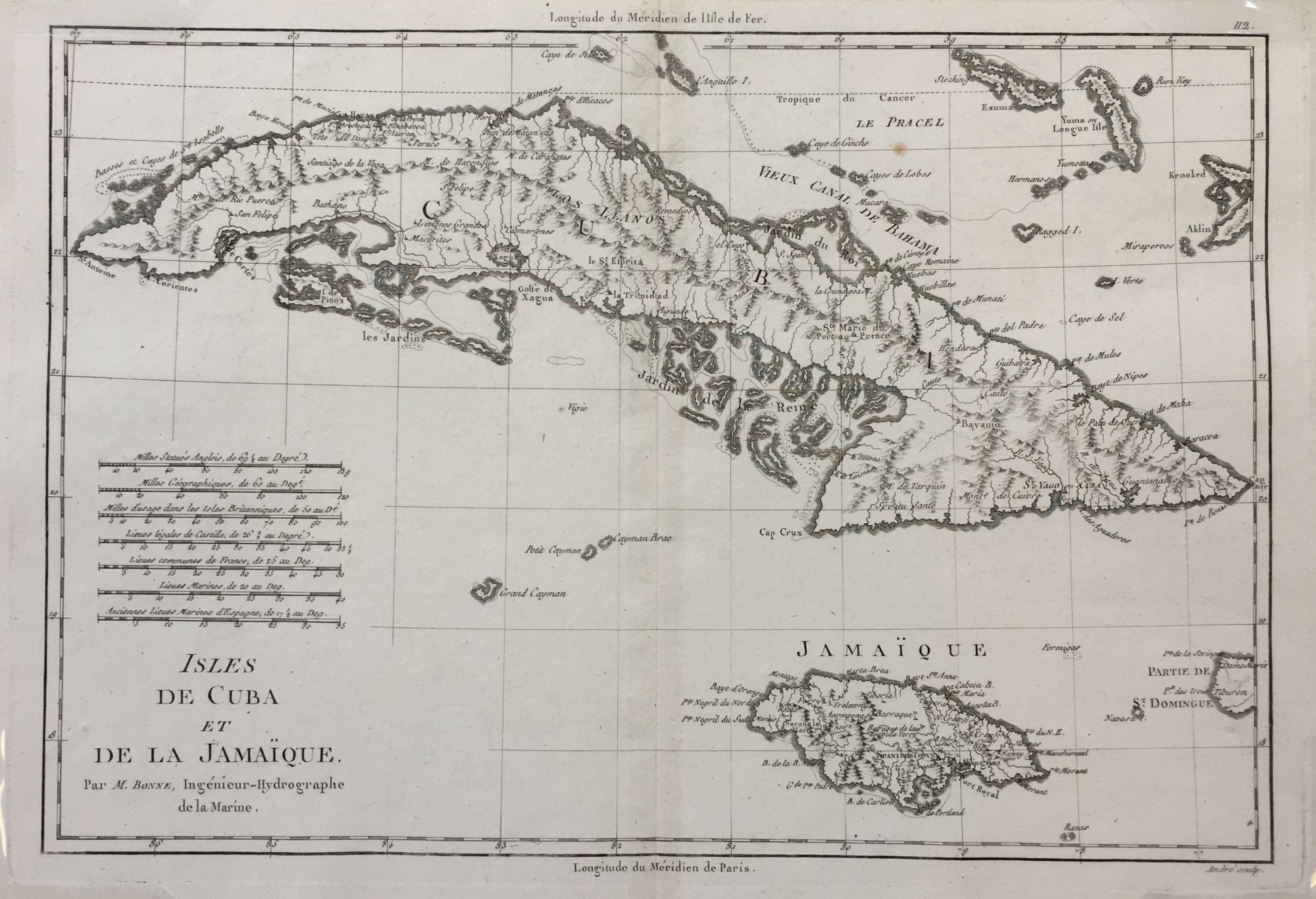
Isles de Cuba et de la Jamaïque.; from Atlas Encyclopédique
Paris: 1787-1788. English translation: Islands of Cuba and Jamaica
10 ¾ x 15 5/8 inches; 9 1/4 x 13 5/8 inches within the neat line; plate mark visible; topographical detail; one light spot; near fine. Near fine. Item #287
Charles Marie Rigobert Bonne (1727-1795) a French cartographer and hydrographer, in 1773 he became the Royal Hydrogrpaher at the Depot de la Marine, a French royal appointment. This is a detailed topographical map of the island of Cuba and Jamaique to the south. The northeast corner of the map shows some of the Bahama islands.
Price: $400.00
See all items in
Maps
See all items by Rigobert BONNE