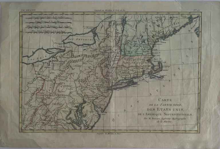
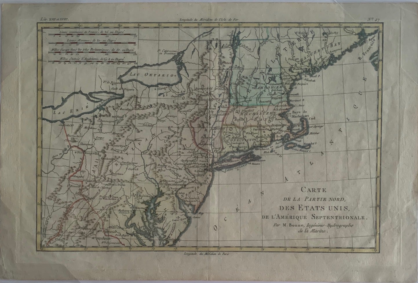
Carte de la Partie Nord, Des Etats Unis, de l’Amérique Septentrionale, Atlas de Toutes les parties Connues du Globe Terrestre,; English : Map of the Northern Part, United States, North America
Geneva: J.L. Pellet, 1780. Map no binding. 10 1/8” x 15 ¼”, 8 ¾” x 12 ½” within the neat line; plate mark visible; hand-colored; light creasing to lower right corner; fine. Fine. Item #660
Published during America’s War of Independence from Great Britain (1176-1783), this map features the mid-Atlantic region of the country and New England, north into Canada, and west into Ohio following Lake Erie. One of the interesting sites noted on the map is Pentagouet in what is now northern Maine, the site of the town of Castine. First settled in 1617 by the French, it is the oldest permanent settlement in New England, and was the capital of Acadia, the settlement of New France in North America.
Price: $275.00