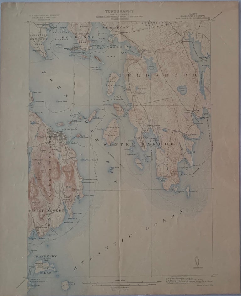
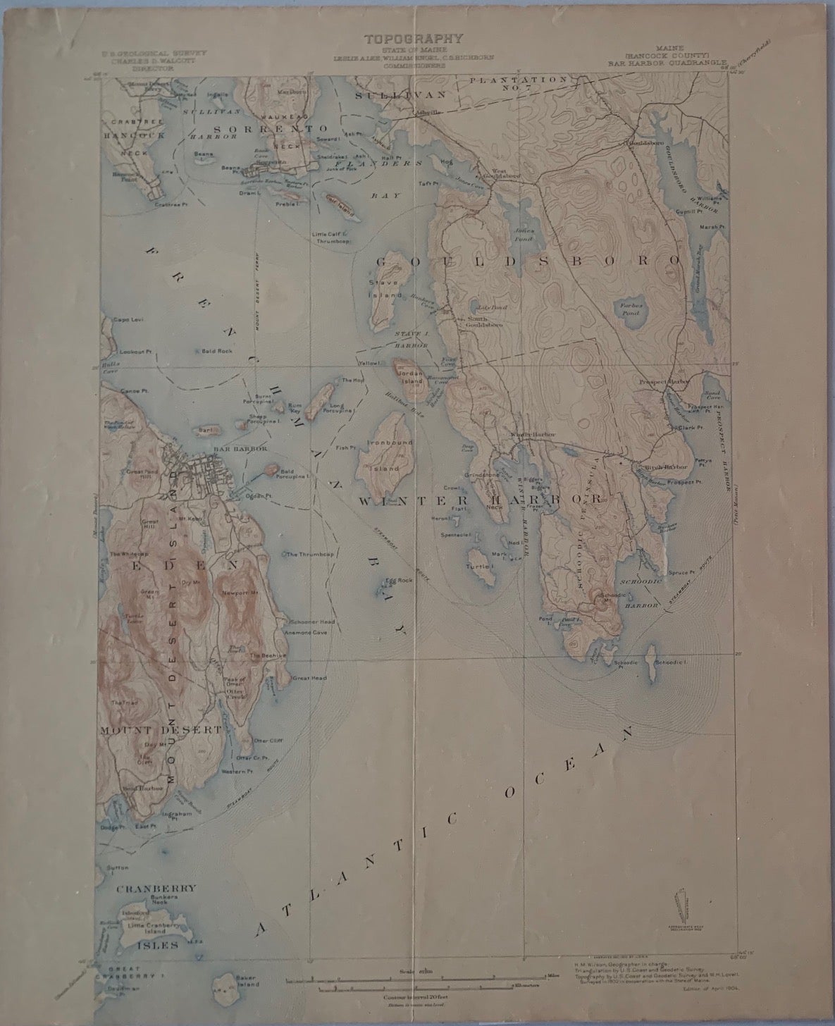
Maine (Hancock County), Bar Harbor Quadrangle, Topography, State of Maine, U.S. Geological Survey, Charles D. Walcott, Director
[U.S. Government], Feb. 1904. Map no binding. Surveyed 1902. 20” x 16 5/8”, 17 ½” x 12 5/8” within the neat line; map printed in sepia, blue and black; verso has description of topographic maps and Conventional Signs listed; center vertical fold as issued; ight age-toning to edges, separation at bottom fold and a few pin-holes along fold; very good plus. Very good +. Item #662
Includes the following areas and towns in Maine: Bar Harbor, Cranberry Isles, Eden, Gouldsboro, Hancock Neck, Ironbound Island, Mount Desert, Plantation No. 7, Sorrento, Stave Island, Sullivan, Winter Harbor, etc.
***SUGGEST: if planning to frame the map, cut the archival top-loader down the sides with a box-cutter to remove the fragile map.***.
Price: $40.00