
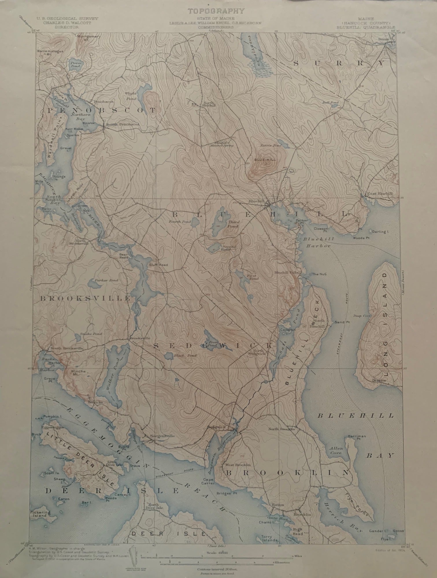
Maine (Hancock County), Bluehill Quadrangle, Topography, State of Maine, U.S. Geological Survey, Charles D. Walcott, Director
[U.S. Government], Feb. 1904. Map no binding. H.M. WILSON, Geographer in charge; Triangulation by U.S. Coast and Geodetic Survey; Topography by U.S. Coast and Geodetic Survey and W.H. LOVELL; Surveyed 1902.
20” x 16 5/8”, 17 ½” x 12 5/8” within the neat line; map printed in sepia, blue and black; verso has description of topographic maps and Conventional Signs listed; light age-toning to edges; near fine. Near fine. Item #673
Includes the following areas and towns in Maine: Bluehill, Bluehill Bay, Brooklin, Brooksville, Deer Isle, Eggemoggin Reach, Little Deer Isle, Long Island, Penobscot, Sedgwick, and Surry.
***SUGGEST: if planning to frame the map, cut the archival top-loader down the sides with a box-cutter to remove the fragile map.***.
Price: $48.00