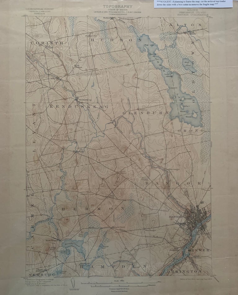
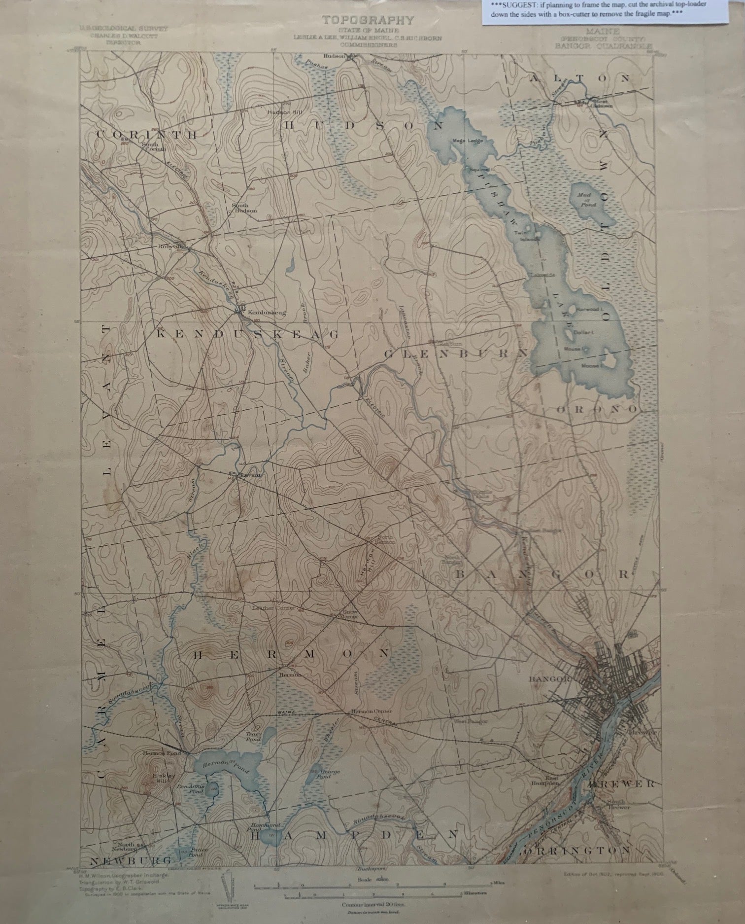
Maine (Penobscot County) Bangor Quadrangle, Topography, State of Maine, U.S. Geological Survey, Charles D. Walcott, Director
[U.S. Government], April 1904. Map no binding. H.M. WILSON, Geographer in charge; Triangulation and topography by U.S. Coast and Geodetic Survey; Revised in 1901 cooperation with the State of Maine, by W.H. Lovell and Hersey Munroe.
20” x 16 5/8”, 17 ½” x 12 ½ ”within the neat line; map printed in sepia, blue and black, verso has description of topographic maps and Conventional Signs listed; light age-toning to edges; near fine. Near fine. Item #675
Includes the following areas and towns in Maine: Alton, Bangor, Brewer, Carmel, Corinth, Glenburn, Hampden, Hermon, Hudson, Kenduskeag, Levant, Mud Pond, Newburg, Oldtown, Orono, Orrington, Pushaw Lake, and railroads.
***SUGGEST: if planning to frame the map, cut the archival top-loader down the sides with a box-cutter to remove the fragile map.***.
Price: $48.00