
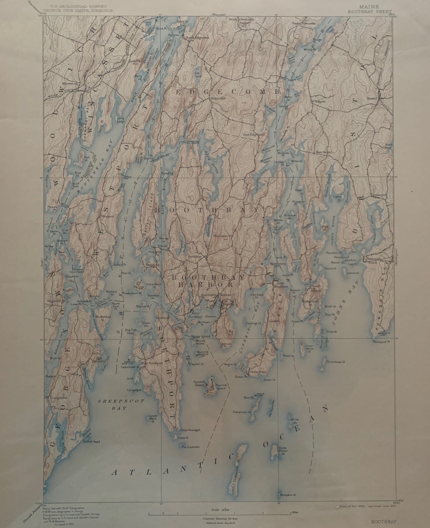
Maine, Boothbay Sheet, Topography, State of Maine, U.S. Geological Survey, George Otis Smith, Director
[U.S. Government], edition of October 1893, reprinted June 1907. Map no binding. Henry GANNETT, Chief Topographer, H.M. WILSON, Geographer in charge; Triangulation by U.S. Coast and Geodetic Survey; Topography by U.S. Coast and Geodetic Survey and W.M. Beaman, Surveyed in 1891.
20” x 16 5/8”, 17 ½” x 12 5/8 ”within the neat line; map printed in sepia, blue and black, verso has description of topographic maps and Conventional Signs listed; light age-toning to edges; near fine. Near fine. Item #676
Includes the following areas and towns in Maine: Atlantic Ocean, Boothbay, Boothbay Harbor, Bristol, Edgecomb, Georgetown, John’s Bay, Linekin Bay, Montsweag Bay, Sheepscot Bay, Sheepscot River, Southport, Westport, Wicasset, and Woolwich.
***SUGGEST: if planning to frame the map, cut the archival top-loader down the sides with a box-cutter to remove the fragile map.***.
Price: $48.00