
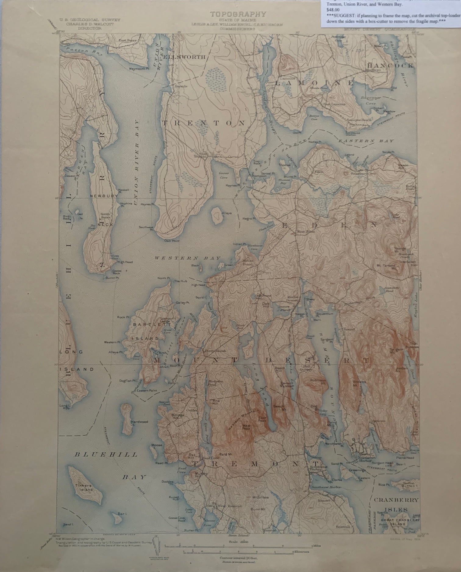
Maine (Hancock County) Mount Desert Quadrangle, Topography, State of Maine, U.S. Geological Survey, Charles D. Walcott, Director
[U.S. Government], May 1904. Map no binding. H.M. WILSON, Geographer in charge; Triangulation and topography by U.S. Coast and Geodetic Survey; Revised in 1901, in cooperation with the State of Maine, by W.H. Lovell.
20” x 16 5/8”, 17 ½” x 12 5/8 ”within the neat line; map printed in sepia, blue and black, verso has description of topographic maps and Conventional Signs listed; light chipping and age-toning to edges; near fine. New. Item #677
Includes the following areas and towns in Maine: Bluehill, Bluehill Bay, Cranberry Isles, Eastern Bay, Eden, Ellsworth, Hancock, Lamoine, Long Island, Mount Desert, Patten Bay, Surry, Tinkers Island, Tremont, Trenton, Union River, and Western Bay.
***SUGGEST: if planning to frame the map, cut the archival top-loader down the sides with a box-cutter to remove the fragile map.***.
Price: $48.00