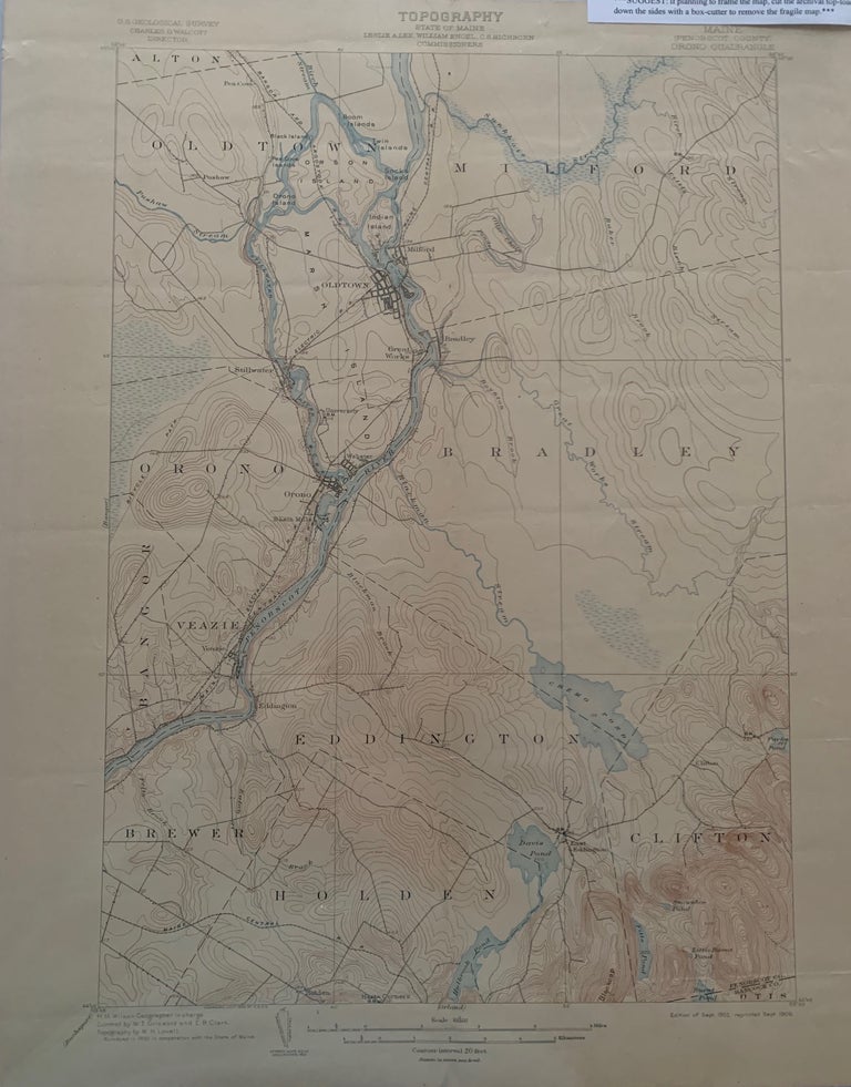
Maine (Penobscot County) Orono Quadrangle, Topography, State of Maine, U.S. Geological Survey, Charles D. Walcott, Director
[U.S. Government], Edition of Sept. 1902, reprinted Sept. 1906. Map no binding. H.M. WILSON, Geographer in charge; Control by W.T. Griswold and E.B. Clark, Topography by W.H. Lovell, surveyed in 1900 in cooperation with the State of Maine.
20” x 16 5/8”, 17 ½” x 12 ½ ”within the neat line; map printed in sepia, blue and black, verso has description of topographic maps and Conventional Signs listed; light age-toning to edges; near fine. Near fine. Item #678
Includes the following areas and towns in Maine: Alton, Bangor, Bradley, Brewer, Chemo Pond, Clifton, Eddington, Holden, Marsh Island, Milford, Oldtown, Orono, Orson Island, Penobscot River, Veazie, and railroads, including Maine Electric Railroad.***SUGGEST: if planning to frame the map, cut the archival top-loader down the sides with a box-cutter to remove the fragile map.***.
Price: $48.00