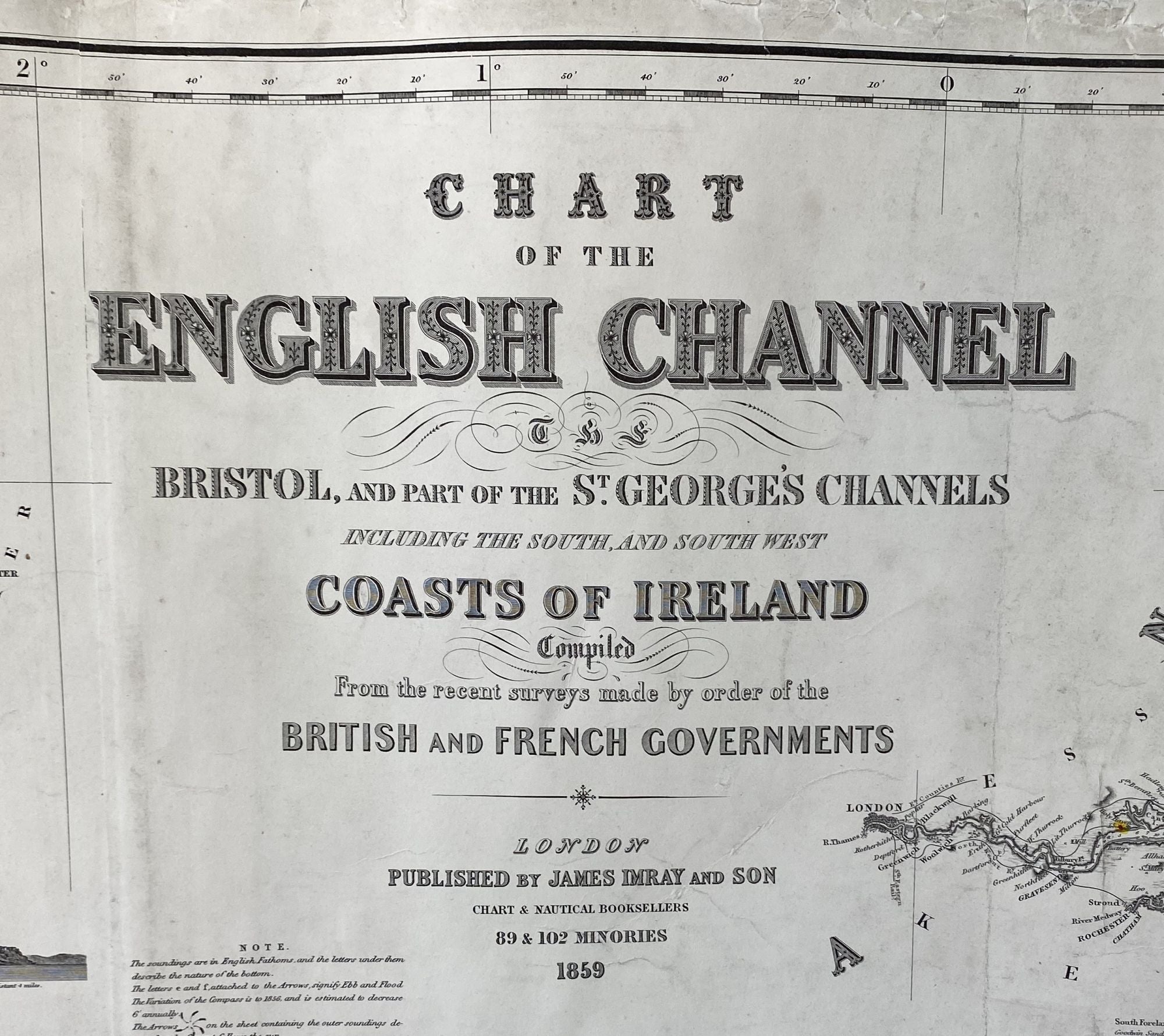
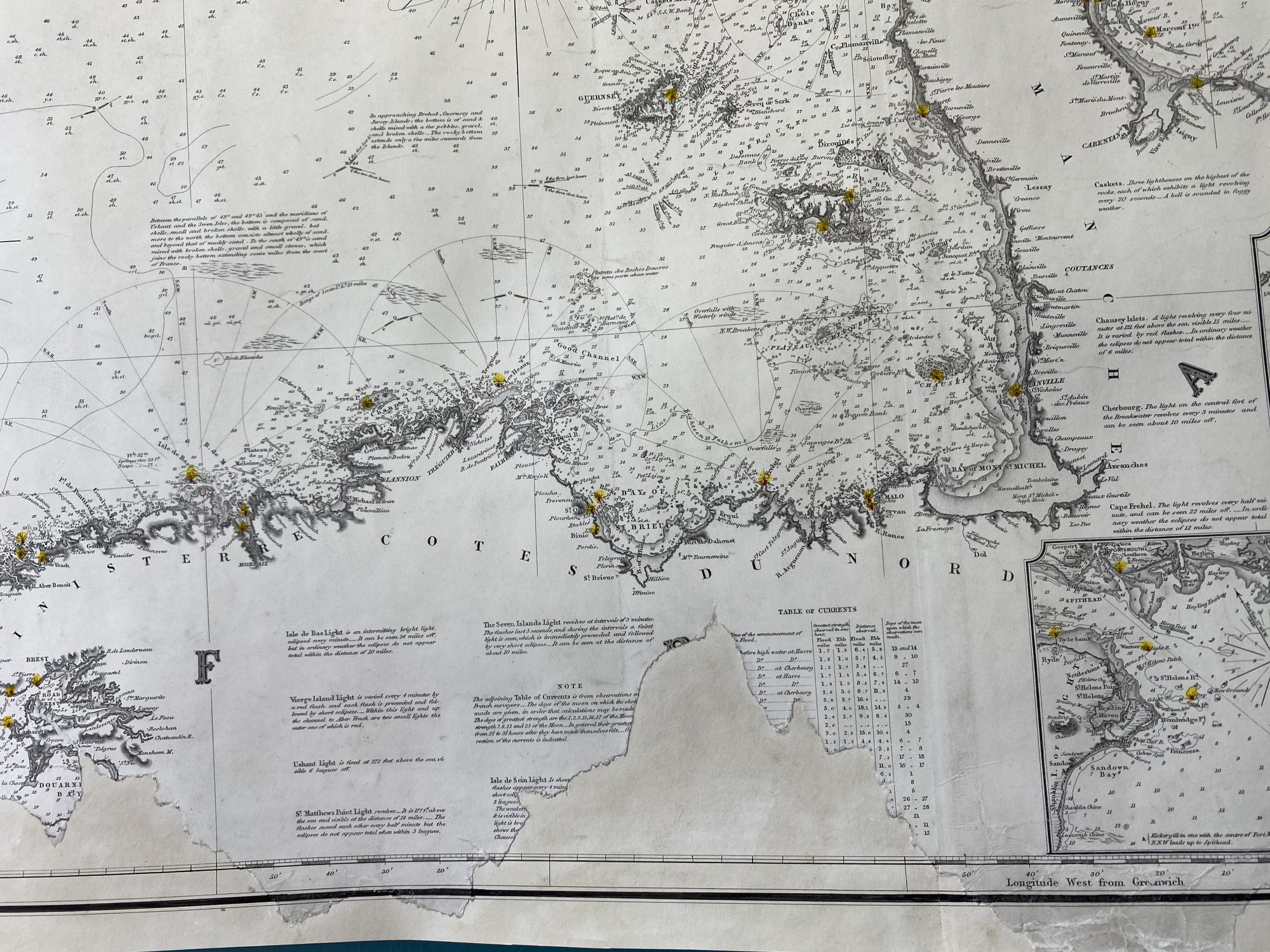
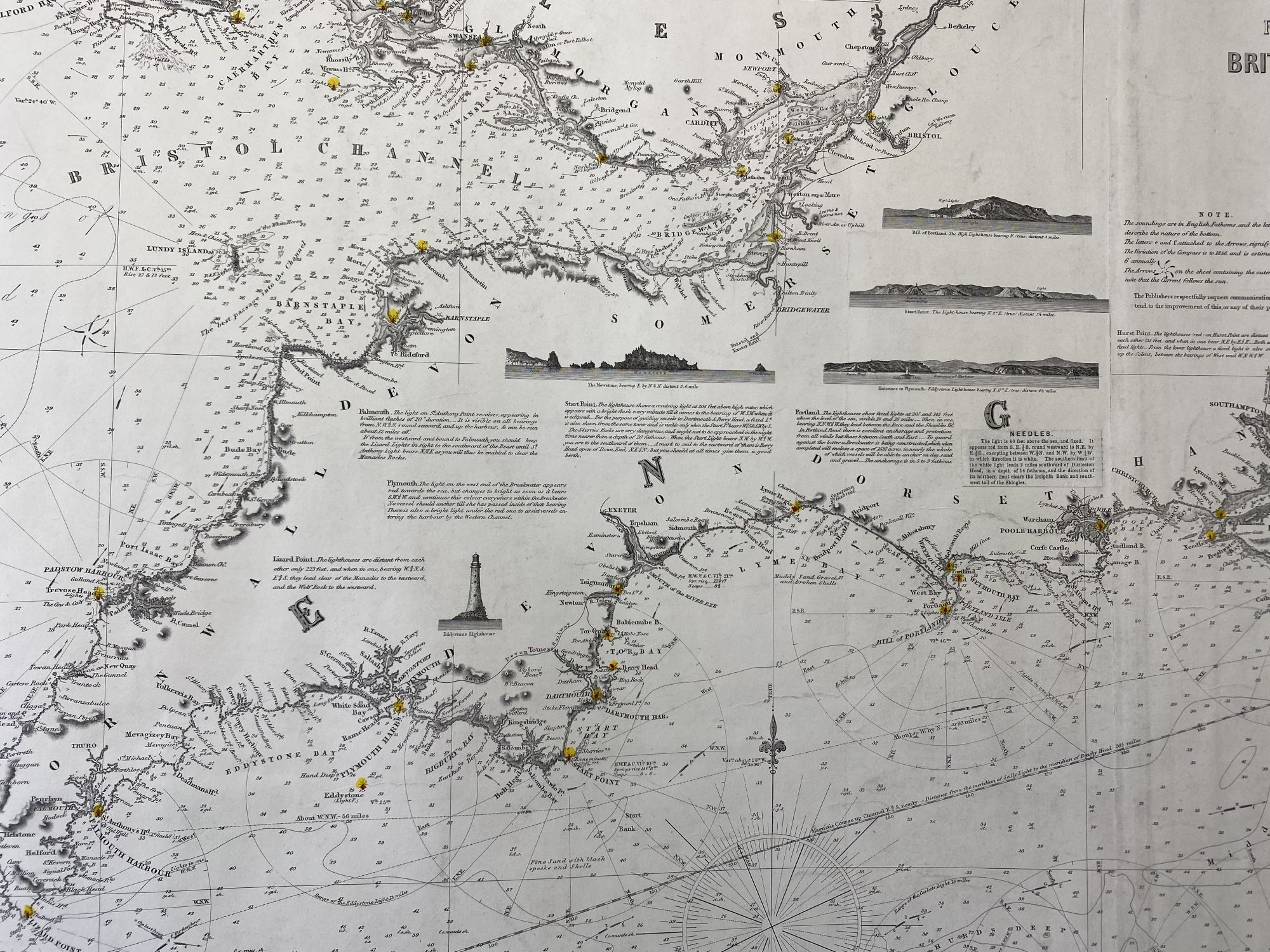
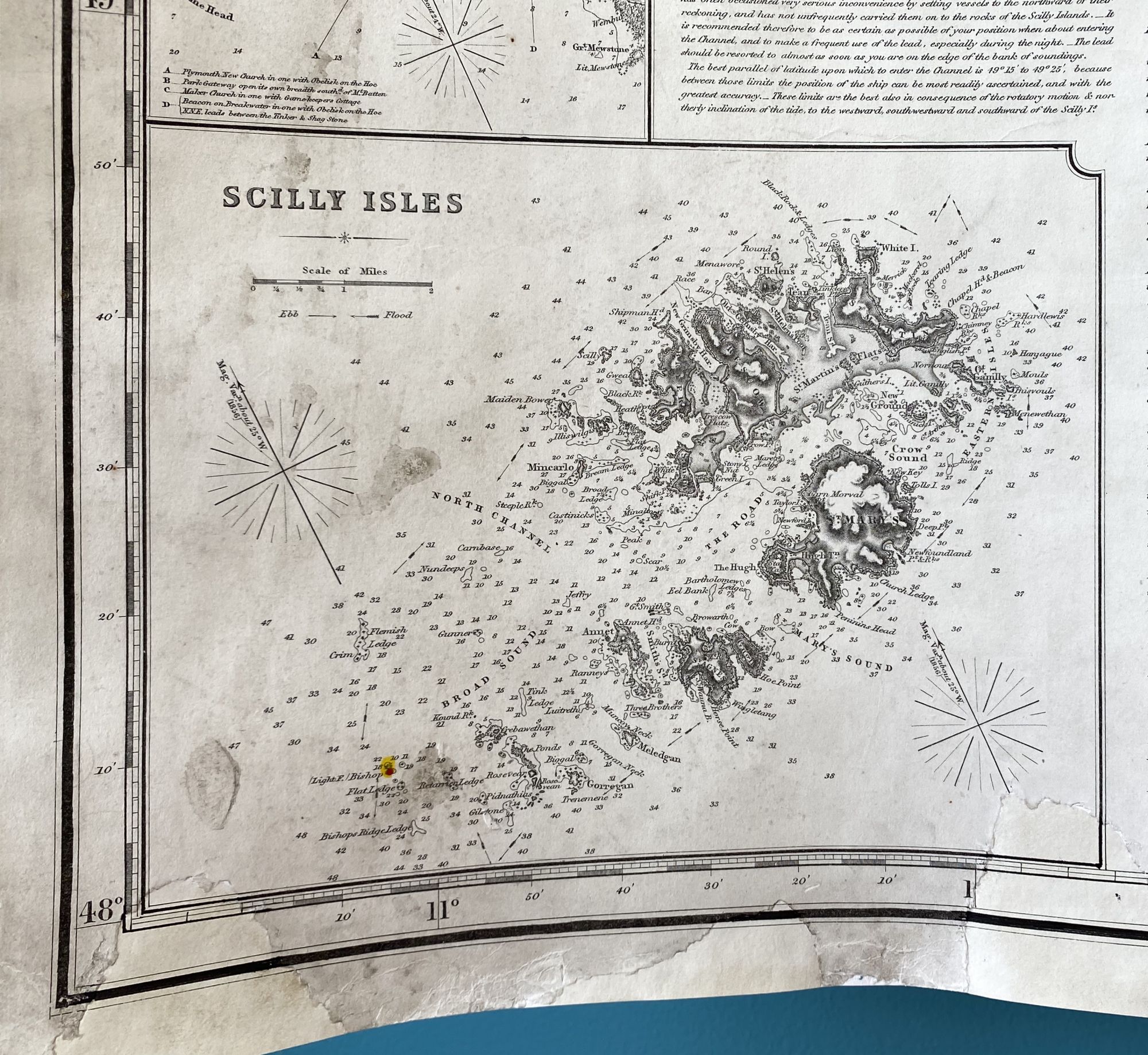
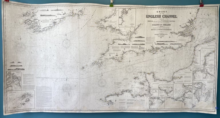
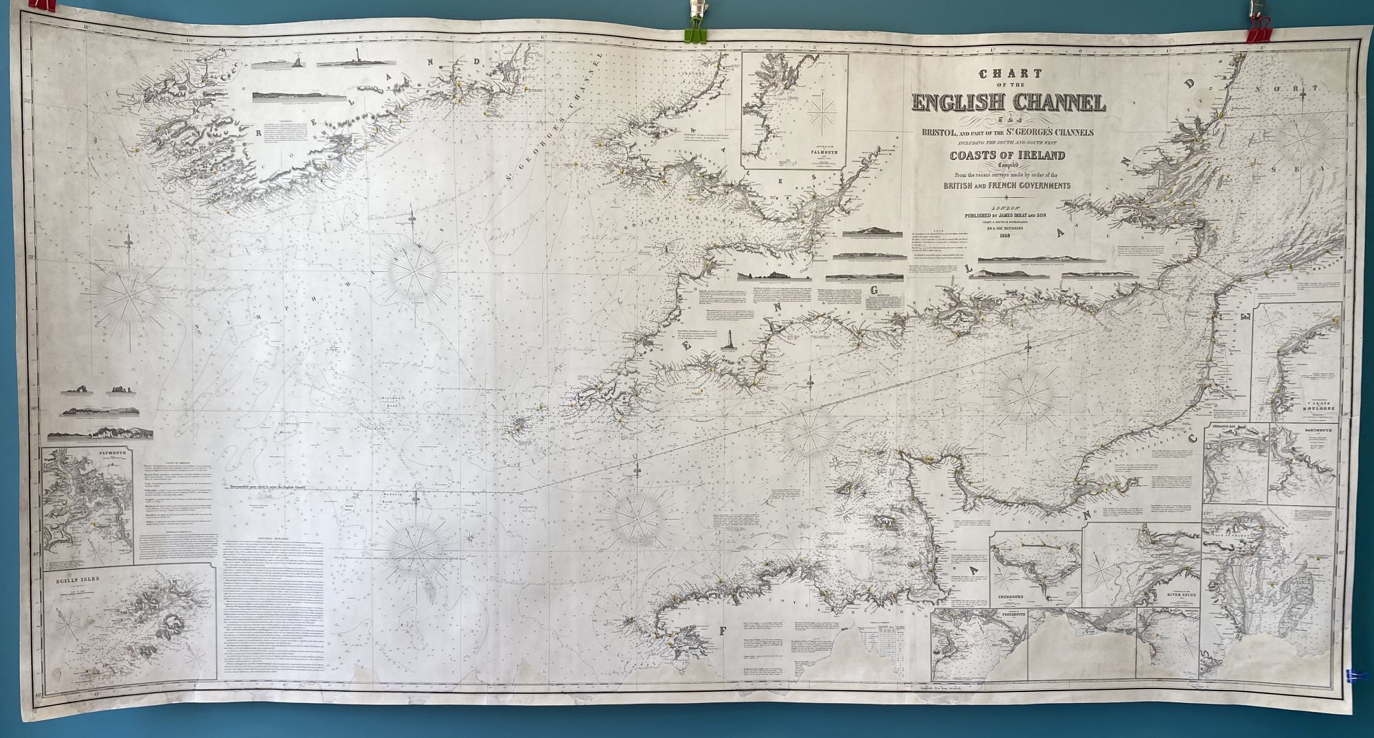
Chart of the English Channel, The Bristol, and part of the St. George’s Channels, including the South, and South West Coasts of Ireland. Compiled from the recent surveys made by order of the British and French Governments
London: James Imray & Son, Chart and Nautical Booksellers, 89 & 102 Minories, 1859/1860. Map no binding. Ten hydrographic detail insets: The Coast from Calais to Boulogne; Cherbourg; Dartmouth 1853; Approach to Falmouth; Penzance Bay 1851; Plymouth; Portland and Weymouth 1860; Approach to Portsmouth 18948; Entrance to the River Seine 1853; and Scilly Isles.
Fourteen land profile charts, 10 showing lighthouses: Beachy Head; Bill of Portland; The Bull; The Cow; Entrance to Crookhaven; Entrance to Dunmanus Bay; Fastnet Rock; The Mewstone; Entrance to Plymouth; The Seven Heads; South Foreland; St. Catherine’s Point
(I. of Wight); Start Point; and Tuskar Rock.
38 ½” x 76 ½”; 3 sheet blue-back chart; lighthouses hand-colored in red and yellow; area of loss affecting one inset at chart righthand bottom; cleaned, conserved, and infill to upper and lower edges, at areas of loss, new blue back lining by Green Dragon Binder, Shrewsbury, MA; very good minus. Located in 3 WorldCat libraries, not all this edition. Very good. Item #940
There is infill to the bottom right of the chart, extending past the neat line, yet it remains an attractive and detailed chart.
Price: $800.00