
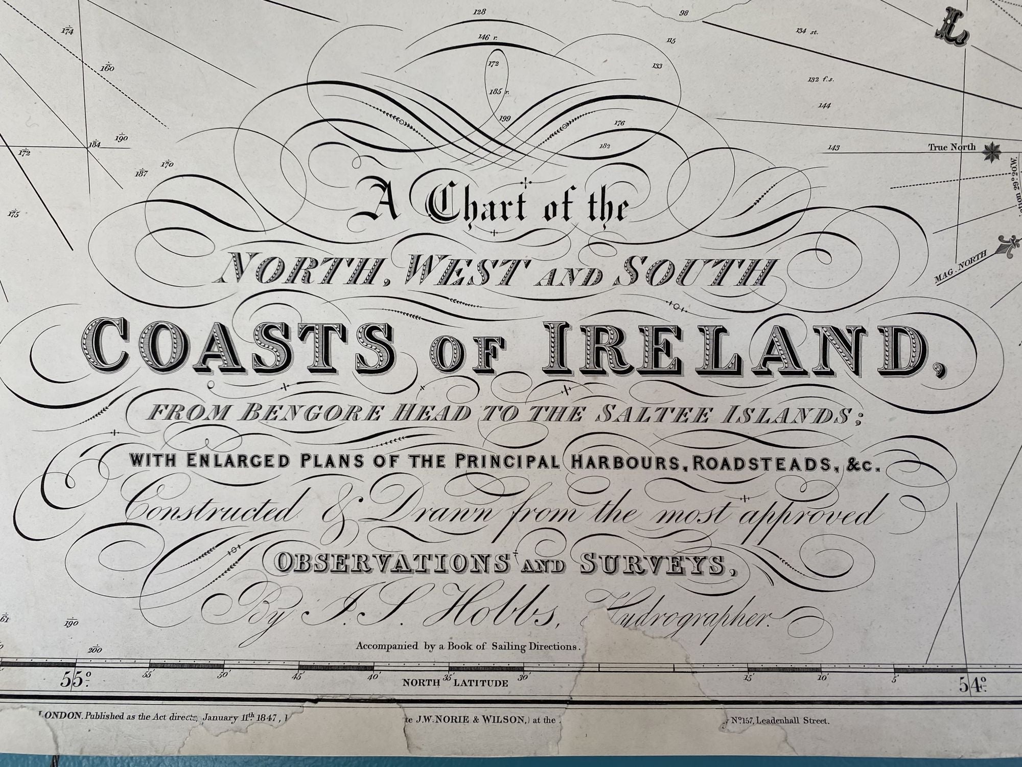
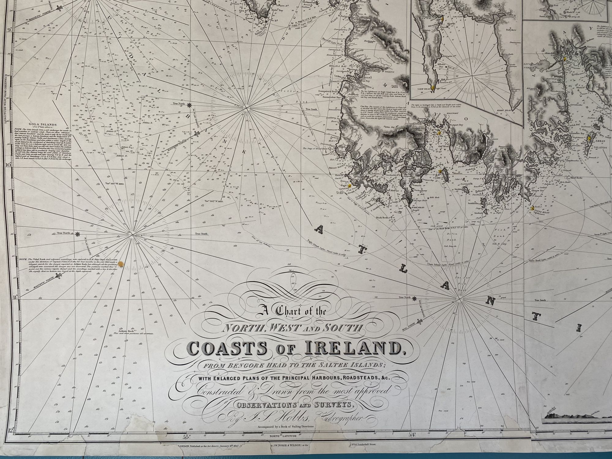
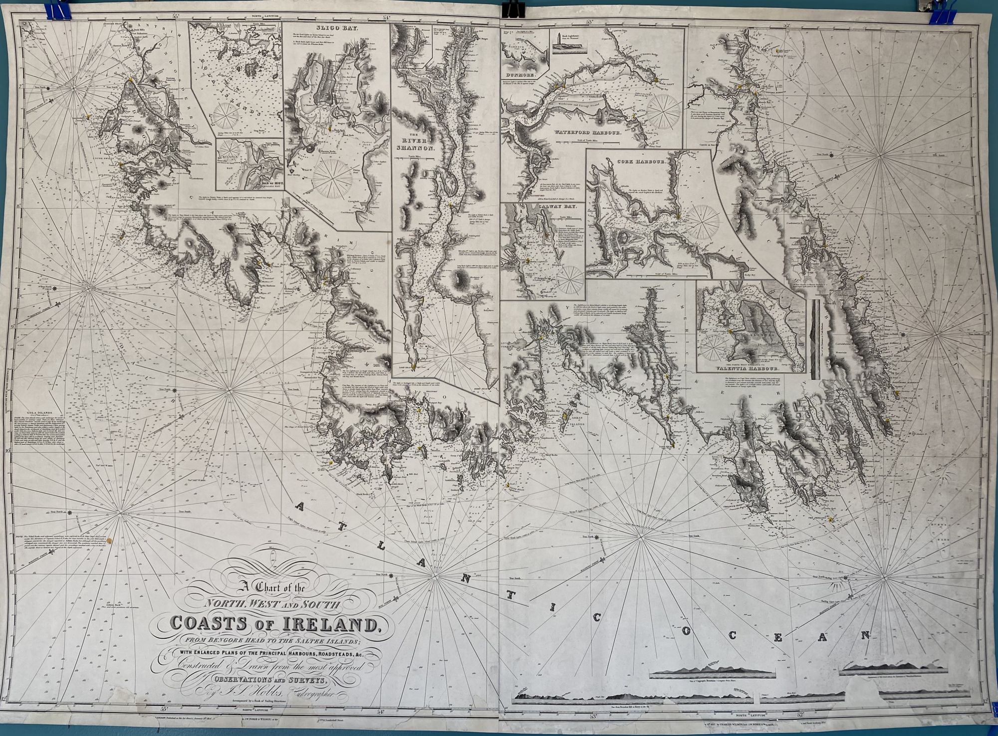
A Chart of the North, West and South Coasts of Ireland from Bengore Head to the Saltee Islands; with Enlarged Plans of the Principal Harbours, Roadsteads, &c. Constructed and Drawn from the most approved Observations and Surveys
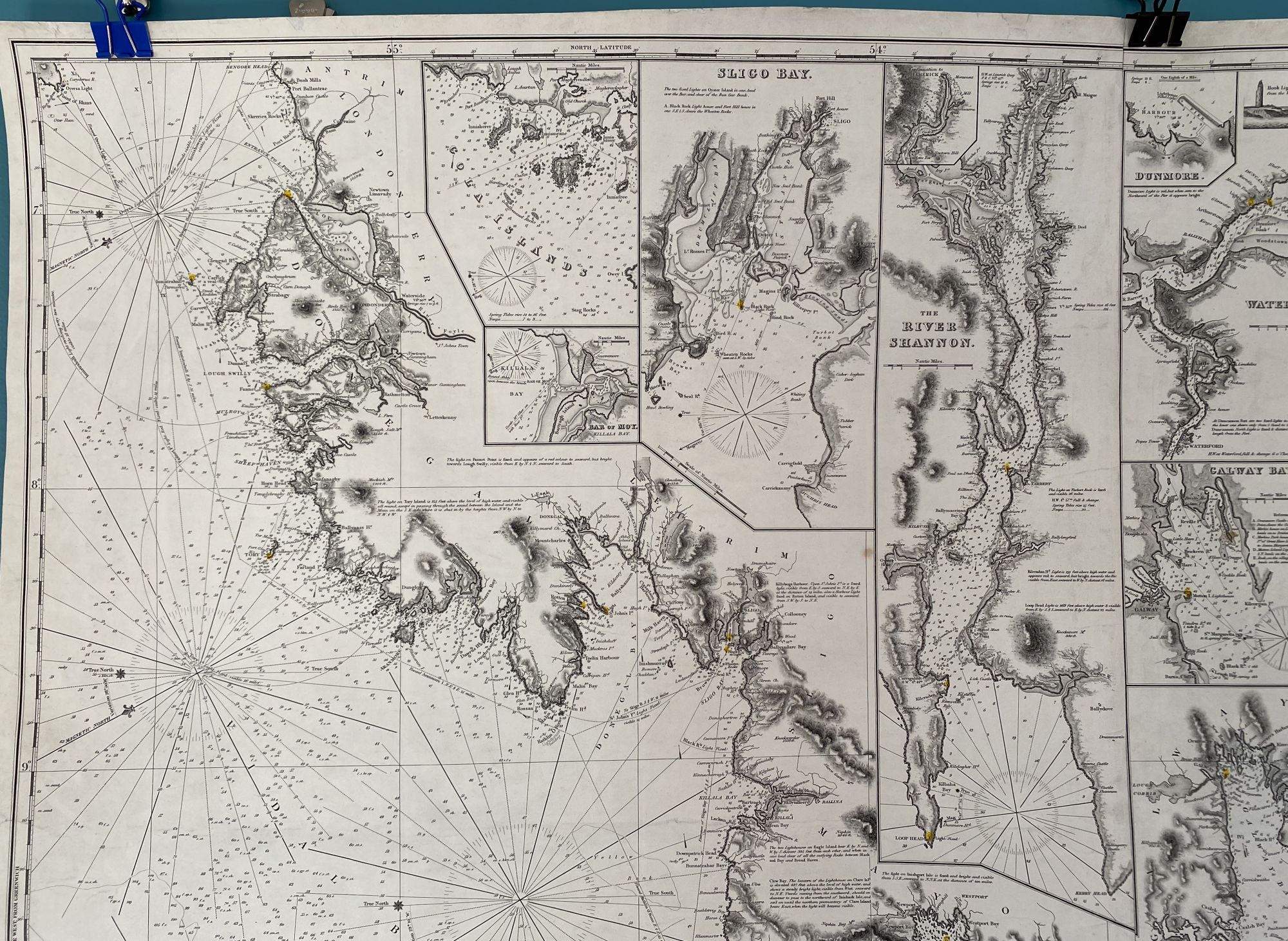
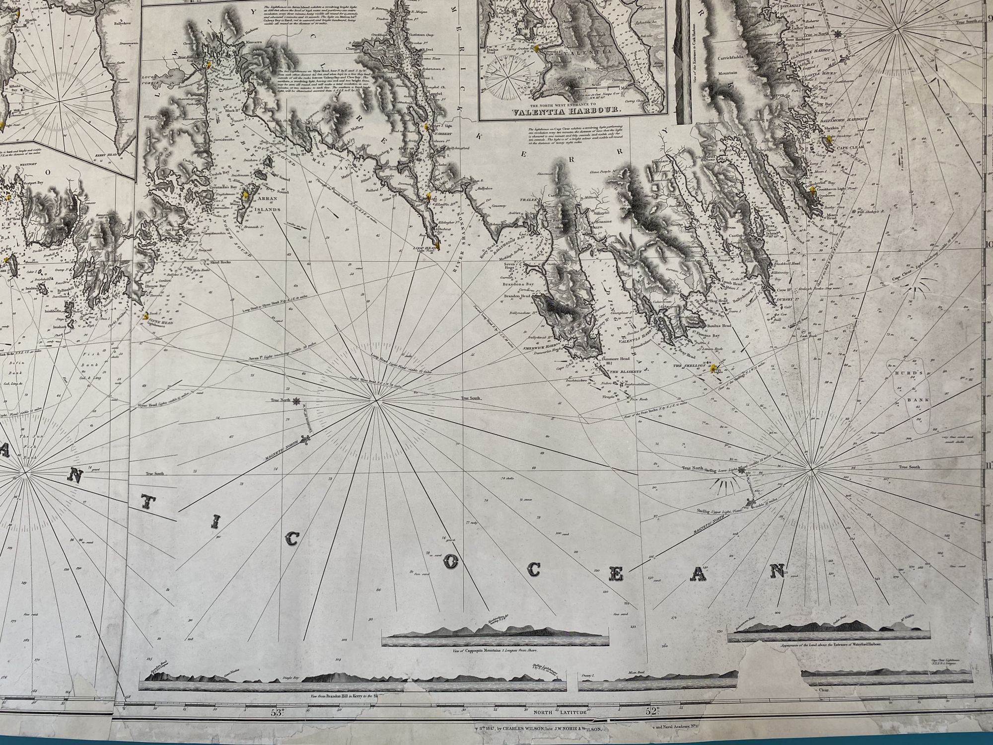
London: J.W. Norie & Wilson, Jan. 11, 1847. Map no binding. Nine insets of hydrographic detail: Bar of Moy, Cola Islands, Cork Harbour, Dumore, Galway Bay, The River Shannon, Slico Islands, Waterford Harbour, and Valentine Harbour.
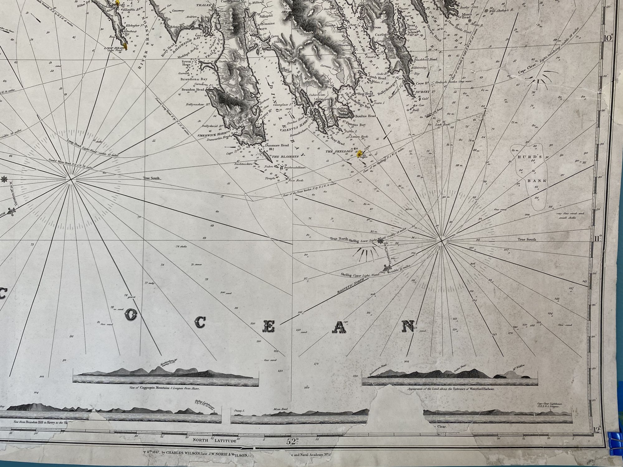
Four land profile charts: Appearance of the Land about the Entrance of Waterford Harbour, View of Cappoquin Mountains 3 Leagues from Shore, View from Brandon Hill in Kerry to the Skelligs Lighthouses, and Dursey Island to Cape Clear Lighthouse.
37 5/8” x 53” within the neat line; two sheet blueback nautical chart; lighthouses hand-colored in red and yellow; 4 geographical profile drawings at bottom right; cleaned, conserved, and infill to chart at areas of loss along bottom edge, some extending through the neat line into the title and the land profile charts, new blue back by Green Dragon Bindery, Shrewsbury, MA; very good minus. Only one located in the British Library at St. Pancras, London. Very good. Item #952
J.S. Hobbs (1813-1874), a British chart maker and hydrographer, was elected to the Royal Geographical Society in 1848 and spent the majority of his professional life producing charts for Norie & Wilson in London. This chart was produced during The Great Famine or Potato Famine in Ireland (1845-1849), the worst year being 1847, a time that saw mass emigration of the Irish to England, Wales, Scotland, North America (both Canada and the United States), and to Australia. From a local Maine coastal barn, this uncommon nautical chart has been professionally conserved.
Price: $850.00